Saturday, 15 February 2014

The Birth of the Piave


The source of the Piave lies high up in the Dolomites on the slopes of Monte Peralba, above the alpine village of Cima Sappada.  Cima Sappada is marked on the map of Ethnographical Itineraries in Veneto  Itinerary 1  as 'Sappada'.  There are several tributaries of the Piave marked on the map as the 'sorgenti  del Piave', but one in particular on Monte Peralba is regarded as the 'true source' by the Italian people.  The Piave River is important in the history of Italy, as it was where the Italian forces stood firm against the Austro-Hungarian armies in WW1, the waters of the river 'running red with blood'.  The momentous events of that time are remembered in stirring songs, still sung to this day.

In 1998 I flew to Milan and thence by train and bus to Cima Sappada, basing myself and my folding bicycle Una at the truly wonderful and hospitable Hotel Belvedere.

A souvenir from a stay in Cima Sappada in 1998

The view of Cima Sappada from my room at the hotel was stunning.  The village is surrounded by the Dolomite peaks on all sides, with the mist constantly drifting through them.


Cima Sappada in the misty Dolomite Mountains
© Peter Alexander Gray 1998

The next morning Una (full name Una Bicicletta) and I set off on the long ascent of the road that rises out of the valley following the Piave to the source.  You can tell from the photo (above) that the way we took was steep


The morning sun burning off the mountain mists
© Peter Alexander Gray 1998


The Dolomite Mountains (originally called the Eastern Alps) dwarf everything in the field of view.  

Once a coral reef, the rock is soft and there are many landslips.  The mineral composition was discovered by a French geologist - Dieudonné Sylvain Guy Tancrède de Gratet de Dolomieu.  (His mum just called him Dieu for short.)

On journeys through Italy you will find many tiny shrines by the roadside, or on the banks of streams and rivers.  There is such a shrine to be found on the ascent of Monte Peralba, on the bank of the stream that is the source of the river.


Shrine seen in the dappled light shining through the trees
© Peter Alexander Gray 1998


Offerings to Santa Maria di Luggau
© Peter Alexander Gray 1998

Behind bars, inside, are flowers and other offerings to Santa Maria di Luggau.  

Each year since 1804, in the third Saturday of September, the people of the locality gather before dawn at Cima Sappada to make a pilgrimage.  

They ascend the road to the source of the Piave and then head over the border, to the Austrian town of Luggau and the Santuario di Santa Maria.

There they give thanks to the Holy Mother (whom they believe, in centuries past, spared the region from the plague) before returning to Cima Sappada for a mass the next day.


Maintained with true devotion...
© Peter Alexander Gray 1998
Up and up, we went... 


From Cima Sappada to the refuge on the Piani del Cristo
Carte e Piante Turistiche Tobacco sheet 1


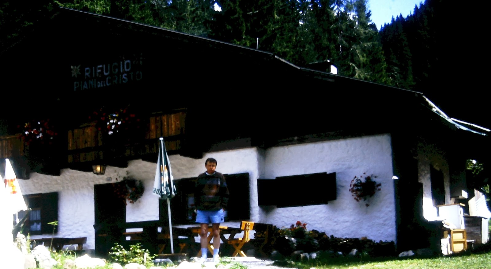
Fortunately,there is the Rifugio Piani del Cristo (circled) en route that allows for exhausted cyclists to collapse and take in food and liquids of all types.  


Cyclist burning out (me)
© Peter Alexander Gray 1998


They have, arrayed above the bar, a whole range of bottles of grappa. After eating a hearty lunch I tried one infused with lemon and basil.   Magnificent... the only word I could find...


Lady behind the bar watching anxiously as grappa accesses the parts beyond the reach of Heineken 
© Peter Alexander Gray 1998

Somehow, setting off again, the mountain seemed a lot steeper.  And there was a long, long way to go...

The hard slog, onwards and up, to the end of the road...
Carte e Piante Turistiche Tobacco sheet 1

About a mile from the end of the road I came across an estate car pulled into a makeshift lay-by on one side, the owner snapping away with his camera.  A polite enquiry (along with a pleading look designed to convey total exhaustion) as to whether it was much further to the source of the Piave immediately persuaded the good man to open up the rear of his vehicle and in a matter of moments Una was stowed safely inside.  

Collapsing into the passenger seat I realised fully for the first time why man had felt the need to invent the motor car.


The Source of the Piave
© Peter Alexander Gray 1998
There at last... The Piave seeps out of the ground on Monte Peralba, forms a little pool and trickles down the mountainside.  There is a stone WW1 monument with an Italian military helmet atop, and a plaque which reads in Italian 'Here is born the Piave'.  You can find more images here.


The church at the source of the Piave
 © Peter Alexander Gray 1998

Not far from the monument is a tiny church.  Despite the size, inside it is a treasure trove.


Madonna and Child above the altar
© Peter Alexander Gray 1998
There are very many beautiful little churches in Cadore.  This is one of them...


High up on one wall, Psalm 103
© Peter Alexander Gray 1998

But it was time for my departure, to set off from here to follow the Piave on the river's long, eventful journey to Venice and the Adriatic.  Here, in the Dolomite mountains, is where the journey starts.

Note: This blog supports readers of The Door of Perarolo, a historical novel set in Cadore, Italy in the early nineteenth century.  You may examine feedback from readers in the UK here and in the US here.  The Door of Perarolo is a Kindle ebook comprising 140 chapters.  It can be downloaded from Amazon sites worldwide.  The launch post of this blog gives further details.  The second post provides links to maps, etc.

Monday, 20 January 2014

New Year 2014 Postbag


Many thanks to all of you who have written to me or posted reviews since the launch of The Door of Perarolo in September 2013.  Across the water I extend my thanks to Martin in the US for his kind comments in his review on the Amazon.com website and to Susan in Calgary, Canada, for writing to me to say that she has recommended the book to a host of Canadian readers.  I'm also most grateful to those of you have posted reviews on the Amazon.uk website.

Richard in Dore village, England, has written with the following queries, and I'd like to address them in this post, as they are questions that re-occur in feedback from readers.  


I've just looked at your latest blog.  Nice pictures of the rafts.
I guess they only made one way journeys. What did they do with them at the river mouth?
Were they worth anything?  How did the raftsmen get back up the river?
Interesting your mention of Pont Neuf in Paris... Despite being called Pont Neuf it's actually the oldest bridge over the Seine.  What made you pick that one for the book?

The originals of the raft photos are even better in the book La Via del Fiume (Cierre Edizioni, Verona), for  I scanned them at reduced definition for the post.  Yes, the rafts did indeed make a one-way journey, being re-crewed at each port on the river.  The main cargo out of Perarolo was timber.  At Codissago some of this was unloaded and the raft re-cargoed with stone cut from the local quarries.  The stone (in the form of lintels, arches, column sections and so forth) was unloaded at Belluno and other major towns en route to Venice.  As for the rafts' timbers... Venice was hungry for wood for building work and for carpentry.  But mostly, the rafts would have been scrapped for fuel for domestic fires.  Yes, they were worth a price - Venice, build as it is on islands in the lagoon, had to import all its timber.

As for returning home, the raftsmen slept in their homes in their home port until around midnight, and then walked upriver back to their place of work.  For the zattieri of Codissago, this meant returning to Perarolo.  The rafts they had brought down that day to Codissago were taken downriver by crews from Belluno and Capo di Ponte.  The only time the zattieri undertook the the whole journey from Perarolo to Venice was when they were piloting the huge rasi - the rafts made of timbers for ships' masts.  This occurred only during the brief period of the French occupation. 

I have had the same experience as Richard and his wife when visiting old European towns.  Discovering Paris at the beginning of the 19th century was tricky.  During that century they they pulled lots of it down to build the boulevards.  So what you see nowadays isn't how it was then.  You'd be surprised how much of 'old' Paris (and other European cities) isn't more much more than 100 - 150 years old!

To understand what European towns and cities were like in the early nineteenth century I researched, many years ago, the diary of Charlotte Harriet Beaujolois Campbell.    


'Beaujolois' as she was known in her family, as a 14-year-old, kept a diary of a journey from London to Florence in 1817.  The original hand-written diary was discovered by  the scientist and historian GR de Beer and published in London in 1951.  Over a number of years, I followed in stages the journey described in the diary, starting at Montgeron (east of Paris), hitch-hiking the old coach roads, and journeying east through Sens, Besançon, through the Jura Mountains into Switzerland (then through Valais, over the Simplon pass into Italy, still following Beaujolais' diary, and arriving eventually into Florence to find the house they made their new family home).

She writes:

At the very gates of Paris we turned off to Charenton.  The road followed the outskirts of Paris and I felt doubly the disappointment of not going there by being so very near.

They spent the night in a hotel at Montgeron before heading off to Sens the next day, to stay at the Le Grand Cerf.  So, you see, I have Beaujolois to thank for the name of the hotel where Xavier and Lucien Fortin were brought up...

Reaching Switzerland, the family lingered in Lausanne, waiting for news that the heat in Italy was abating, for it was a hot summer there.  Before I arrived for the first time in Lausanne, my mental picture of the town was scanty.  I believed it was situated on the shores of Lake Geneva (the correct name in French is Lac Léman) and was the centre of the International Olympic Committee.  I arrived by train, for a business trip, and, looking at all the old houses in the immediate neighbourhood, I was convinced I was about to walk the streets that Beaujolois had walked two centuries before.  I couldn't have been more wrong!

Here are my research notes from the time, with Beaujolois' diary notes in red:

LAUSANNE 09/07/2000

Arrived via Geneva to attend a conference for the week.

The Rue de Bourg, summer 1893
(Lausanne 1860-1910, Louis Polla, Payot Lausanne)
Before arriving in Lausanne, I had thought (as perhaps anyone might), that the old centre of Lausanne was to be found near the centre of the modern town - perhaps somewhere near the railway station?  Not so!  In 1817, Lausanne was a walled town atop the hillside about a mile above the lake.  The red arrows on the map show the route the Campbells' carriage would have taken between the lake and the old town, through vineyards (see below).

31:08:1817

We spent five days at the Hotel du Lion d’Or...

This seemingly innocuous diary entry was to lead to my first real break. One evening while walking up the town (the streets of Lausanne are steep), I met a resident of Lausanne who informed me of the existence of a model of the town as it would have been in the early 19th century. It was to be found, he said, in the museum next to the cathedral. I explained that I was looking for the Lion d’Or, which drew a blank look. I added that it was probably close to the rue du Bourg.

He corrected me: 'La rue de Bourg?' (A slight change of name since1817, or a minor error in the diary of the fourteen-year-old Beaujolois). It was, he explained, one of the oldest streets of Lausanne. He took me there.


The photograph (left) from the museum records, shows the Rue de Bourg in the summer of 1893.  Importantly for me it states (in French):‘the great building with eight windows per floor, on the right at the bottom of the street, was the ancient hotel the Lion d’Or...in 1832, it was considered to be an establishment of great reputation, much visited.  It was furnished with baths.’ 

The records also reveal that its address was No. 29 Rue de Bourg, and that it closed, finally, in 1842.  The houses on the left hand side of the street would have been the last of the houses lying inside the old town walls, which would have been seen by Beaujolais as her coach entered via the St François gate.  Demolition of the old town walls commenced in that century, though well after 1817.  

Famous patrons  included:

1769 Emperor Joseph II
1810 Ex-empress Josephine
1815 Queen Hortense
1822 The King of Prussia

Looking down the Rue de Bourg, old Lausanne (Photo: PAG )

The photo opposite of a model of the old walled town of Lausanne was taken inside the Musée Historique de Lausanne.  The red arrow indicates the Rue de Bourg descending in the direction of the church of St François.  Down (left, outside the walls) the hill below the old town, the land running down to the lake was, in 1817, entirely set to vines.  Around 1850 the walls were demolished, and thereafter the vineyards were gradually encroached by urban development.  All that remains today of the old fortifications is a single watchtower, La Tour de L’Ale; the vineyards are all gone, and houses stretch all the way down the hill to the lakeside.  Now was the time to visit the rue de Bourg with my camera, to see the hotel where Beaujolois stayed...


Early morning, Rue de Bourg  (PAG)

Down the street, on the right: the Lion d’Or.  Once the proud residence of kings, it is now a pizza house!  The traditional market stalls still do good trade so, on a limited budget, I stocked my back-pack with fruit and tomatoes.  The young woman who sold them to me explained that the Rue de Bourg was the street where the bourgeoisie had lived – on the outskirts of the town.  ‘Bourg’ is origin of the term ‘bourgeoisie’, she added.  As we chatted in a happy mixture of French, English and Italian, she told me that she had a degree from Lausanne University, specialising in Etymology; she still studies in the evenings, in order to become a teacher.


Enough, for the present of the Campbells' journey to Florence.  That trip to Lausanne taught me how to look at all the towns she described in her diary of 1817, en route to Florence.  

But the Campbells skirted Paris on that journey, so I could get no description of the city from Beaujolois' diary.  

What would Paris have been like in at the beginning of the nineteenth century?  Much different from modern Paris.  John Stockdale (Piccadilly, London) produced a detailed map of Paris, then a walled city, in 1800. 

Paris, 1800

No sign of the boulevards.  The Tuileries Palace is still in place (later burnt down by a mob during another revolution).  To answer Richard's question: 

If we look closer, we can see the number of bridges are few...  It was the only bridge in Paris at that time that didn't have houses built on it (houses like the ones on the Ponte Vecchio in Florence which can still be seen in modern times), and thus it allowed traffic and pedestrians to pass over easily.


Isle du Palais
Part of Key to Stockdale's map

The 'New Bridge', 40 on the key, is the Pont Neuf.  


Renoir's painting of  Le Pont Neuf

It has been painted over the years by countless artists, including Renoir.  The bastions of the bridge, resembling the boxes found in theatres, were and are still popular meeting places for lovers.  Hence the choice for the book.  

Please, keep up the feedback! Some of you were asking about the next book, and how many books about the zattieri, the history and culture of Venetia, and so forth, are planned.  To answer: I'm working on the next book at present, so may limit myself to a new post every month from now on; including The Door of Perarolo, there are four books planned for the series in total.

Note: This blog supports readers of The Door of Perarolo, a historical novel set in Cadore, Italy in the early nineteenth century.  You may examine feedback from readers in the UK here and in the US here.  The Door of Perarolo is a Kindle ebook comprising 140 chapters.  It can be downloaded from Amazon sites worldwide.  The launch post of this blog gives further details.  The second post provides links to maps, etc.

Sunday, 15 December 2013

Zattere


In 1992 several zattere (three section rafts) were built in the traditional way to recreate the journey down the Piave from Perarolo to Venice.  I am obliged to Cierre Edizioni in Verona for allowing the publication in this blog of some of the beautiful photographs from their fascinating publication, La Via del Fiume (Cierre Edizioni, Verona, 1993). 

Three zattere on the riverbank at Perarolo in 1992
The three rafts (above) were pictured moored at Perarolo.  In modern times the water level at this point of the river is no longer sufficient to support rafting, and water from the dam upstream at Pieve di Cadore was released to allow the rafts to make their journey downriver.


On the river


The stretch of water between Perarolo and Codissago is still treacherous though, when the river is running deep.  The oarsmen use the oars to move the zattera sideways, or to align it with the mouth of a cataract, or to steer the raft in order to avoid dangers such as rocks and submerged trees.


Passing by Longarone

The zattieri di Codissago were all big, strong men.  Great strength was required to steer the zattera as it raced down the river.  The front oars were the most difficult to work.  The zattieri wore spiked boots to enable them to grip the decking.  Ahead, downriver, the Spiz Gallina (Hen's Beak) looms over the left bank of the Piave.


Rough water

If the water was rough, two men were needed to work each oar.  In the tool bag (centre of raft) can be seen a traditional had operated auger (drill), of the type used to build the zattere and also to effect repairs as the craft moved downriver.  


An oar in the rest position showing the handles

Each oar had two handles, a side handle and a handle at the end of the oar.  Rope was a precious commodity, used only for tying up the rafts or for lashing down the deck cargo.  In the photograph above, the oar is fastened with twisted hazel.  This material was used everywhere in the construction of the rafts.  


When arriving in Cadore, for example by train to Perarolo, one is struck by the great diversity of trees that grow in the Piave valley.  Hazel grows as well as any, and the shoots of hazel are easy to cut with a machete, as the photo to the left shows.


When twisted, the fibres of hazel (nocciolo in Italian) shoots shear to form strong sections of 'rope' - una saca di nocciolo.  Because the zattere were on a one-way journey to Venice (where the cargo was removed and the zattere broken up for lumber) everything used in the construction of the raft had to be disposable - and wood such as hazel was to be had a-plenty for free.


The  saca was used to join two section of the raft together.  This ingenious mechanism gave the raft the flexibility required to ride over submerged banks of gravel without breaking up. The  saca was also used to fasten the blades of the oars to the shafts, to build the oar posts, and to hold the oars in place.


Zattieri di Nervesa

The Door of Perarolo opens with a scene on the bridge at Nervesa.  Nervesa was one of the last ports on the Piave before Venice.  Here the river ran slowly and, having gathered the waters of all major tributaries, was wide and relatively easy to navigate.  The zattieri  working out of the port didn’t need the strength of the men of Codissago to operate the oars.  A typical crew might contain a mix of men of all ages.  The photograph above is from a postcard dated 1900.

Note: This blog supports readers of The Door of Perarolo, a historical novel set in Cadore, Italy in the early nineteenth century.  You may examine feedback from readers in the UK here and in the US here.  The Door of Perarolo is a Kindle ebook comprising 140 chapters.  It can be downloaded from Amazon sites worldwide.  The launch post of this blog gives further details.  The second post provides links to maps, etc.


Tuesday, 19 November 2013

Codissago

Codissago... home of the master raftsmen of the Piave, the zattieri di Codissago.  The village can be found on a map of the region to the north of Belluno, on the left bank of the Piave River.  Castello Lavazzo can be found on the right bank, to the north, while Longarone is situated on the right bank, to the south.  (‘Right’ and ‘left’ are as seen by a zattiere standing on a raft looking downriver).


N to S: Castello Lavazzo, Codissago and Longarone
Carte e Pianta Turistiche Tobacco sheet 21

The zattieri di Codissago not only navigated the most treacherous waters of the Piave, they also built the rafts in Perarolo, having walked through the night to start work on their construction at daybreak.  


Commemorative logo from the 2008 walk
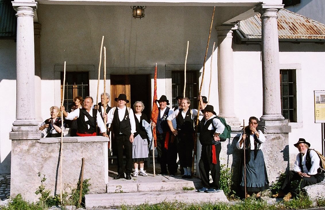
In 2008, my daughter Jenny and I were invited to join the descendants of the zattieri di Codissago on their annual commemorative walk.  

Around midnight we left our hotel in Belluno and, in a car borrowed from an Italian friend (thanks, Barbara!), drove to Codissago.

The walk commenced at a pre-arranged house in the village and, through the night, stopped at many on the small villages en route.  The first stop was at Termine where refreshments were provided for us all.  We were joined there by two cars driven by carabinieri who were our escorts on the long walk north.


It'd been a long hike through the night, but we were nearly there...
Photograph © Peter Alexander Gray 2008


By daybreak we were on the final approach Perarolo, where the photo above was taken.  The reception in Perarolo was marvellous, with much feasting and celebration!


Photograph © Peter Alexander Gray 2008
In Codissago, the church where Lucia and Saverio were married still stands, but times change, and all commercial rafting on the river has now ceased.  This was partly due to the arrival of the railways - but also the progressive industrial and agricultural use of the water resources up to modern times has taken its toll.   From the 1940s onwards, water was taken from the rivers and streams of the Piave valley via a network of dams and tunnels for the generation of HEP (hydro-electric power) at the power generating station at Sovèrzene.  Some of the water was also diverted onto farms for the irrigation of crops.  As a result, today the Piave has no longer the depth of water required for commercial rafting.

Apart from one occasion (for a RAI TV documentary, when water was released from the dam near Pieve di Cadore), there has been no rafting of the Piave in recent times.   

The quay where the zattere were to be seen moored in twos and threes has gone, and the small quarry close by has been gated up, and is used now as a centre for driving instruction for would-be motorists!  


The church still plays a major part in the lives of the people of Codissago
Photograph © Peter Alexander Gray 2008

The church may be grand and beautiful, but a hundred years or so ago it wasn't the only place of worship...


Small is beautiful?
Photograph © Peter Alexander Gray 2008
A perspex screen prevents entry to this tiny chapel, once a place for Christians to meet and pray together.  To the top left of the photograph you can glimpse the bell tower of the main church of Codissago.


Coro di Codissago and zattieri standing on a three-section zattera
In the town, life goes on.  There, as everywhere, the future is with the young people, the new generation.  Coro di Codissago are a local choir (see the link in Useful Links), seen here standing on one of a number of zattere constructed and sailed down the Piave, filmed for the RAI TV program.  Note the clever, simple mechanism for joining the sections together - this mechanism allowed the rafts to pass over the rough river bed without the sections breaking apart.  The 'rope' used by the zattieri when constructing the rafts was made simply by twisting lengths of hazel shoots.  The shoots were immersed in water in stone troughs for long periods before  they were twisted (this sheared apart the fibres and made the hazel pliable) to make the 'rope'.  A traditional zattera had two forward-facing oars at the front and two trailing oars at the stern.  The handle of one of the forward-facing oars can be seen at the left of the photo.


The bell tower of the church at Castello Lavazzo
Photograph © Peter Alexander Gray 2008

Across the Piave, upstream from Codissago, is found the the village of Castello Lavazzo.  So-named in the time frame of The Door of Perarolo, the place name nowadays has been changed to Castellavazzo after a recent referendum.  

To the back of the village was a quarry where stone blocks were extracted for building stone, columns, lintels and so forth.  These were passed on a conveyor close by the church across the river to Codissago and thence, via the rafts, downriver.

The travel writer Amelia Edwards sketched the village in the early morning while staying at the inn at Longarone in 1872.  The bridge over the Piave (bottom right-hand corner) leads to Codissago.  The description of the inn in her book Untrodden Peaks and Unfrequented Valleys is the basis of the description on the inn where Padrig Droug had his office in The Door of Perarolo.   


Castello Lavazzo as sketched in 1872
She says: 
'LONGARONE , seen at six o'clock on a grey, dull morning, looked no more attractive than at dusk the evening before. There had been thunder and heavy rain in the night, and now the road and footways were full of muddy pools. The writer, however, was up betimes, wandering alone through the wet streets; peeping into the tawdry churches; spelling over the framed and glazed announcements of births, deaths, and marriages at the Prefettura; sketching the Pic Gallina, a solitary conspicuous peak over against the mouth of the Val Vajont, on the opposite bank of the Piave; and seeking such scattered crumbs of information as might fall in her way.'  


I'm afraid she wasn't very complimentary in general about her stay in Longarone!  Before breakfast that same morning she also sketched the Spiz Gallina - the Hen's Beak.  In the book she labels it 'Pic Gallina'.


Looking South down the Piave valley from Castello Lavazzo
Photograph © Peter Alexander Gray 2008
In modern times the 'Hen's Beak' still towers over the left bank of the Piave (you can glimpse the river, shrouded by trees along its banks, at the foot of the image towards the centre), and the church at Codissago (seen left of centre) remains.  But Longarone as Amelia Edwards and others at that time knew it was largely destroyed, fifty years ago, in the Vajont Dam disaster of October 1963. Yet in those fifty years much new industry has arrived into Longarone, and modern factories have been built, providing work for the people of  succeeding generations.  The zattere no longer ply the river trade, but the community around the towns of the valley hereabouts is alive and vibrant.

Note: This blog supports readers of The Door of Perarolo, a historical novel set in Cadore, Italy in the early nineteenth century.  You may examine feedback from readers in the UK here and in the US here.  The Door of Perarolo is a Kindle ebook comprising 140 chapters.  It can be downloaded from Amazon sites worldwide.  The launch post of this blog gives further details.  The second post provides links to maps, etc.