This post is one of the last few in the sequence (starting with The Birth of the Piave) that transcribes an audio diary recorded during a journey down the Piave valley, from the source of the Piave on Monte Peralba to Venice, in the summer of 1998.
 |
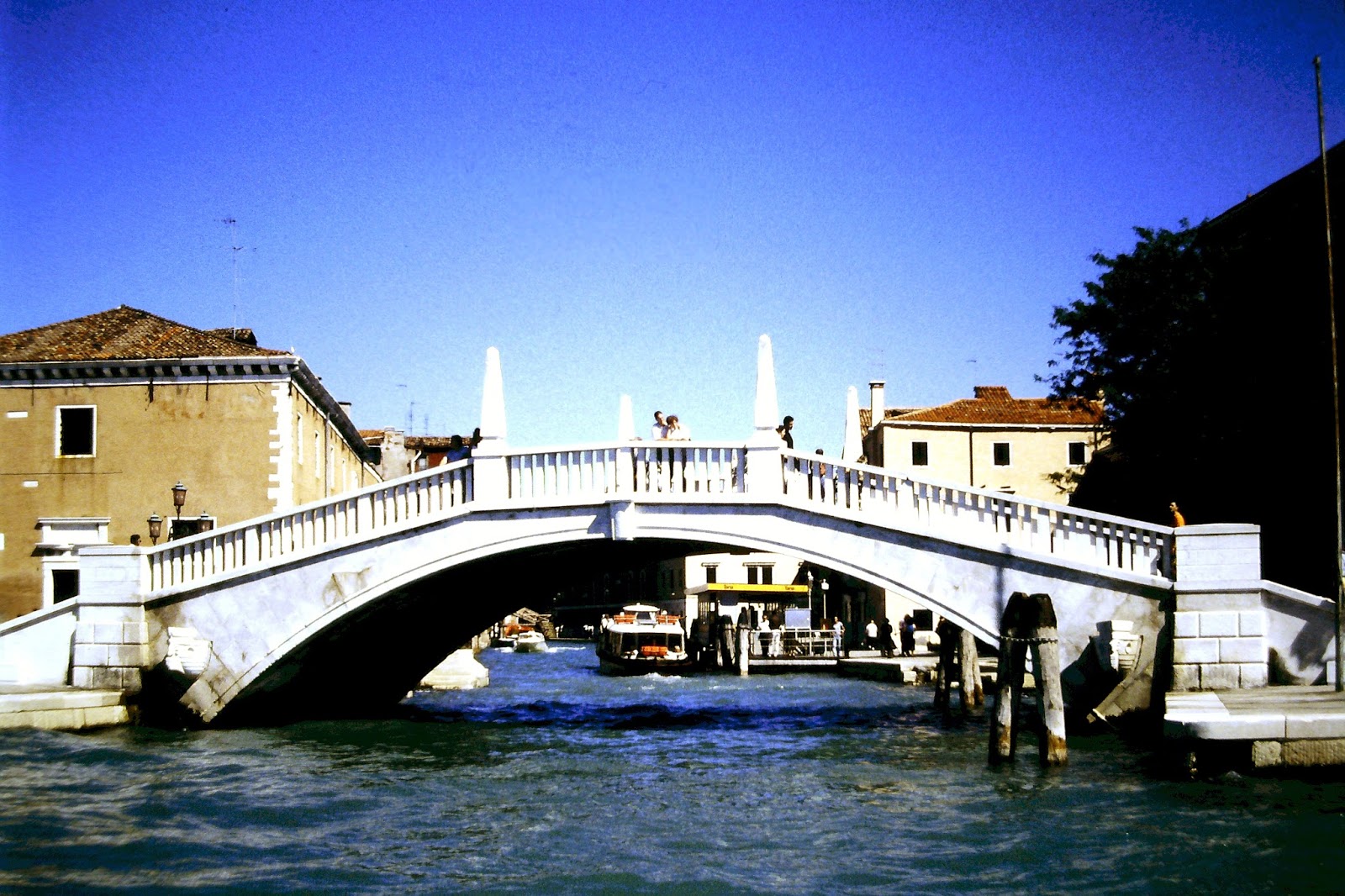
| Briccole [© P.A.G. 1998] |
I arrived in Venice on the first Sunday in September - Regatta Day - with my Italian friends Dario and Michele, to indulge in some sightseeing: the Rialto, the Lido and now... a trip around Venice's famous lagoon on a hired motor launch.
One of the most common sights in the lagoon is a set of three (sometimes more) posts used for marking the navigable channels, providing moorings, or both.
One of the most common sights in the lagoon is a set of three (sometimes more) posts used for marking the navigable channels, providing moorings, or both.
These are made from a special oak which has given its name to the posts: briccole.
The wood decays when immersed in the lagoon and has a natural enemy: the shipworm - a woodboring mollusc that attacks wet or rotting timber.
The wood decays when immersed in the lagoon and has a natural enemy: the shipworm - a woodboring mollusc that attacks wet or rotting timber.
Much argument has been made for and against the use of synthetic materials in place of oak.
Recently it has been decided to allow such materials to be used within the lagoon (though not in the canals to replace the wooden mooring poles there).
But one man's enemy is another's friend...
Recently it has been decided to allow such materials to be used within the lagoon (though not in the canals to replace the wooden mooring poles there).
But one man's enemy is another's friend...
 |
| Oak attacked by shipworm [courtesy Antico Trentino] |
Oak attacked by shipworm is used in the manufacture of all sorts of beautiful wooden artifacts by Antico Trentino. You can find out lots more by following this link.

Antico Trentino is the sole owner of the brand Lebrìc, and is the only company in the world that certifies and guarantees Briccola of Venice with a trademark of origin.
This view of the Venetian lagoon, seen from space, shows a wealth of detail. The outflow plume of fresh water from the Piave Nuovo can be seen at the top of the picture.
(The Piave Nuovo was created to divert the river away from the lagoon, a remarkable engineering achievement, centuries ago. Originally called the Piave Nuova, the gender of the Piave was changed from feminine to masculine in celebration of the Italian victory over the Austro-Hungarian forces at the Battle of the Piave River in June 1918. Shortly afterwards, many regions of Italy were overcome by a new fashion: the fluvial sex change.)
Attribution: I have complied with the attribution specification for the the image above at the end of this post. All other NASA images (like the one below) are simply magnified zones taken from the original high-resolution image.
This magnified view (above) shows shows the outflow of fresh water from the Piave Nuovo in more detail.
The old course of the river, the Piave Vecchio, still snakes its way around the NE shoulder of the lagoon to discharge into the Adriatic, to the south down the coast, as shown in the further magnified image below.
Also visible in the image above are the wakes from individual vessels heading along the coast.
At Caposile the Piave Vecchia joins with the water from the River Sile which flows down from Treviso. The Sile, too, has also been diverted from the lagoon (the waterway is marked 'Tagio del Sile' in blue on the map above), in order to prevent the build up of sediment in the lagoon. At a point just before the river enters the sea at Porto di Piave Vecchia (see map above) there is a lock that connects the Piave Vecchio to a waterway leading into the lagoon.
To the top left of the last NASA image (showing detail of the coastline between the Piave Vecchio and the Piave Nuovo) you can see San Donà on the left bank of the river and Musile, opposite, on the right bank. Musile is where, in the opening chapters of The Door of Perarolo, Fortin's horse was stabled . You can read more about both towns in the blog post entitled A last look at the Piave.
Also on the right bank below Musile you can see the point where the old river course, the Piave Vecchio, diverges from the present main course of the Piave (shown blue) to head south towards the lagoon.
Our trip around the lagoon was a brief one, but took in quite a few things. The Porto di Lido is now the main entrance for shipping arriving into port at Venice. The channel is dredged to allow access for quite large ships - this was one of the smaller ships by which we passed.
Further south along the coast is Porto Malamocco. Readers of The Door of Perarolo will know that this is where the Rivoli, the flagship of the Italian fleet, was towed out of the lagoon before the start of her fateful maiden voyage.
Above is a photo, sent to me by Luigi Boatto, of an old engraving of Malamocco. You can see briccole towards the left of the picture.
The most southerly entrance to the lagoon is the Porto di Chioggia. (Below Chioggia are the mouths of the Rivers Brenta and Adige. The Adige is the second largest of Italy's rivers - the Po is the largest by far, the Piave is the third largest. You can judge the Adige's flow from the outflow plume seen in the NASA image.)
Chioggia, like Malamocco is surrounded by water. It is almost Venice in miniature with its canals and calli. A busy fishing port it is, like Burano (see below), famous for lace making.
Luigi's postcards above show Chioggia in the early twentieth century. The main street is named after Victor Emanuel II, the first king of a united Italy. The Italian monarchy survived until the end of WW2 - Italy, nowadays, is a republic.
Our boat trip around the lagoon didn't take in the islands, one of which is Murano, famous world-wide for the exquisite glassware crafted there. Like Venice, Murano is a really group of islands connected by bridges. You can find Murano on the map just to the north of Venice.
Another island (to the NE of Murano) is Burano, famous in its turn for Burano Lace. It is linked by a bridge to another island, Mazzorbo, to the west, once an important trading centre but now a place of orchards and vineyards.
 |
| Venice Lagoon 9th December 2001 [NASA/GSFC/MITI/ERSDAC/JAROS, and U.S./Japan ASTER Science Team] |
This view of the Venetian lagoon, seen from space, shows a wealth of detail. The outflow plume of fresh water from the Piave Nuovo can be seen at the top of the picture.
(The Piave Nuovo was created to divert the river away from the lagoon, a remarkable engineering achievement, centuries ago. Originally called the Piave Nuova, the gender of the Piave was changed from feminine to masculine in celebration of the Italian victory over the Austro-Hungarian forces at the Battle of the Piave River in June 1918. Shortly afterwards, many regions of Italy were overcome by a new fashion: the fluvial sex change.)
Attribution: I have complied with the attribution specification for the the image above at the end of this post. All other NASA images (like the one below) are simply magnified zones taken from the original high-resolution image.
 |
| Venice Lagoon 9th December 2001 (detail - the Piave Nuovo outflow) [NASA/GSFC/MITI/ERSDAC/JAROS, and U.S./Japan ASTER Science Team] |
This magnified view (above) shows shows the outflow of fresh water from the Piave Nuovo in more detail.
The old course of the river, the Piave Vecchio, still snakes its way around the NE shoulder of the lagoon to discharge into the Adriatic, to the south down the coast, as shown in the further magnified image below.
 |
Venice Lagoon 9th December 2001 (detail - the coastline between the Piave Vecchio and the Piave Nuovo)
[NASA/GSFC/MITI/ERSDAC/JAROS, and U.S./Japan ASTER Science Team]
|
Also visible in the image above are the wakes from individual vessels heading along the coast.
 |
| Showing the route of the Piave Vecchio between Musile and Porto di Piave Vecchia [Venezia, Carta della Provincia, Litografia Artistica Cartografica] |
At Caposile the Piave Vecchia joins with the water from the River Sile which flows down from Treviso. The Sile, too, has also been diverted from the lagoon (the waterway is marked 'Tagio del Sile' in blue on the map above), in order to prevent the build up of sediment in the lagoon. At a point just before the river enters the sea at Porto di Piave Vecchia (see map above) there is a lock that connects the Piave Vecchio to a waterway leading into the lagoon.
 |
| Venice Lagoon 9th December 2001 (detail - the diversion of the Piave Nuovo (blue) from the original course, the Piave Vecchio)
[NASA/GSFC/MITI/ERSDAC/JAROS, and U.S./Japan ASTER Science Team]
|
To the top left of the last NASA image (showing detail of the coastline between the Piave Vecchio and the Piave Nuovo) you can see San Donà on the left bank of the river and Musile, opposite, on the right bank. Musile is where, in the opening chapters of The Door of Perarolo, Fortin's horse was stabled . You can read more about both towns in the blog post entitled A last look at the Piave.
Also on the right bank below Musile you can see the point where the old river course, the Piave Vecchio, diverges from the present main course of the Piave (shown blue) to head south towards the lagoon.
 |
| Ships can now access Venice via the Porto di Lido [© P.A.G. 1998] |
 |
| Boats and ships are passing through the waters of the lagoon at all hours [© P.A.G. 1998] |
 |
Venice Lagoon 9th December 2001 - a view the three entrances to the lagoon.
[NASA/GSFC/MITI/ERSDAC/JAROS, and U.S./Japan ASTER Science Team]
|
The
town of Malamocco is virtually an island,
surrounded as it is by the Adriatic to the east, the lagoon to the west and, to
the north and south, waterways that connect the two.
 |
The
island of Malamocco [courtesy Luigi Boatto]
|
 |
| Map of the area of the lagoon [Venezia, Carta della Provincia, Litografia Artistica Cartografica] |
 |
| Chioggia - Canale di San Domenico early 20th C [courtesy Luigi Boatto] |
Chioggia, like Malamocco is surrounded by water. It is almost Venice in miniature with its canals and calli. A busy fishing port it is, like Burano (see below), famous for lace making.
 |
| Another view of the same canal [courtesy Luigi Boatto] |
 |
| Chioggia - Corso Vittorio Emanuele [courtesy Luigi Boatto] |
Luigi's postcards above show Chioggia in the early twentieth century. The main street is named after Victor Emanuel II, the first king of a united Italy. The Italian monarchy survived until the end of WW2 - Italy, nowadays, is a republic.
Our boat trip around the lagoon didn't take in the islands, one of which is Murano, famous world-wide for the exquisite glassware crafted there. Like Venice, Murano is a really group of islands connected by bridges. You can find Murano on the map just to the north of Venice.
 |
| Burano canal scene [courtesy Luigi Boatto] |
Another island (to the NE of Murano) is Burano, famous in its turn for Burano Lace. It is linked by a bridge to another island, Mazzorbo, to the west, once an important trading centre but now a place of orchards and vineyards.
 |
| Quayside scene, Mazzorbo [courtesy Luigi Boatto] |
Just to the north of Burano in the lagoon is the island of Torcello (see the map previous to the one above) which was once (in pre-medieval times) covered by the houses of a town that as a trading centre was more prosperous than Venice. In its heyday, it is thought that 3000 people lived there. But the northern end of the lagoon silted up from the sediment transported by the rivers at that time, and the waters around the island became a mosquito-infested swamp.
 |
| Aerial view of Torcello [courtesy Luigi Boatto] |
Gradually the population dwindled, and nowadays there are only ten full-time residents on the island. The photo above shows the footprints of buildings since dismantled by the Venetians for their stone. The most notable building, seen above, is the Cathedral of Santa Maria Assunta.
 |
| Canal scene Torcello [courtesy Luigi Boatto] |
You can see the cathedral to the right in this charming image from Luigi's vintage postcard collection.
 |
| Ponte del Diavolo, Torcello [courtesy Luigi Boatto] |
The previous photograph was taken from the Ponte del Diavolo (the name indicating it to be an example of a devil's bridge). The photo above is of the bridge itself.
Despite the tragic decline of Torcello, the island still continues to attract visitors, perhaps the most famous of which was Ernest Hemingway. It was one of the locations where he worked on his novel Across the River and into the Trees - an impressively tedious read. As Alan Coren once said, 'Once I put it down I couldn't pick it up again.'
But our boat trip on the lagoon didn't take us north of Venice, so I have had to rely on Luigi's images to show us the islands there.
 |
| Looking across the lagoon at the Venice shoreline [© P.A.G. 1998] |
The lagoon is a big waterway! These photos were taken from a bobbing boat using my hand-held Pentax SLR. Above, the Venice waterfront showing the campanile in the Piazza di San Marco, with the Doge's Palace to its right. Behind, you can glimpse the spires on the roof of the Basilica di San Marco.
You might think that the campanile in St Mark's square has been standing there for centuries. Not so. The original tower collapsed in 1902.
It was rebuilt ten years later, in the same form.
You might think that the campanile in St Mark's square has been standing there for centuries. Not so. The original tower collapsed in 1902.
 |
| 1902 - the wreck of the campanile in the Piazza di San Marco [courtesy Luigi Boatto] |
It was rebuilt ten years later, in the same form.
 |
| San Giorgio Maggiore [© P.A.G. 1998] |
This photo was taken looking in the direction of view shown by the arrow in the map below. The other campanile visible, on the left, is that of Palladio's beautiful basilica San Giorgio Maggiore, on the island of the same name.
 |
| San Giorgio Maggiore [Dorling Kindersley: VENICE pocket map and guide] |
The wide waterway to the left of the image above is the Canale della Giudecca.
 |
| Ships moored in the Canale della Giudecca in the 19th C [courtesy Luigi Boatto] |
 |
| Regatta day September 1998 [© P.A.G. 1998] |
Note: This blog supports readers of The Door of Perarolo, a historical novel set in Cadore, Italy in the early nineteenth century. You can examine feedback from readers in the UK here and in the US here. The Door of Perarolo is a Kindle ebook comprising 140 chapters. It can be downloaded from Amazon sites worldwide. The launch post of this blog gives further details. The second post provides links to maps, etc.
If you'd like to track these blog posts, you can follow me, Peter Alexander Gray, on Facebook.
I'm grateful for the use of the NASA image[s]; herewith the full attribution of author as specified by Wikipedia:
"Venice Lagoon December 9 2001" by NASA/GSFC/MITI/ERSDAC/JAROS, and U.S./Japan ASTER Science Team - http://earthobservatory.nasa.gov/Newsroom/NewImages/images.php3?img_id=16314. Licensed under Public Domain via Commons - https://commons.wikimedia.org/wiki/File:Venice_Lagoon_December_9_2001.jpg#/media/File:Venice_Lagoon_December_9_2001.jpg.